Queen Maud Land (Antarctica)
Located at the Antarctic Peninsula (70°02’24.4”S 10°48’19.8”E), RGI60-19.00792.
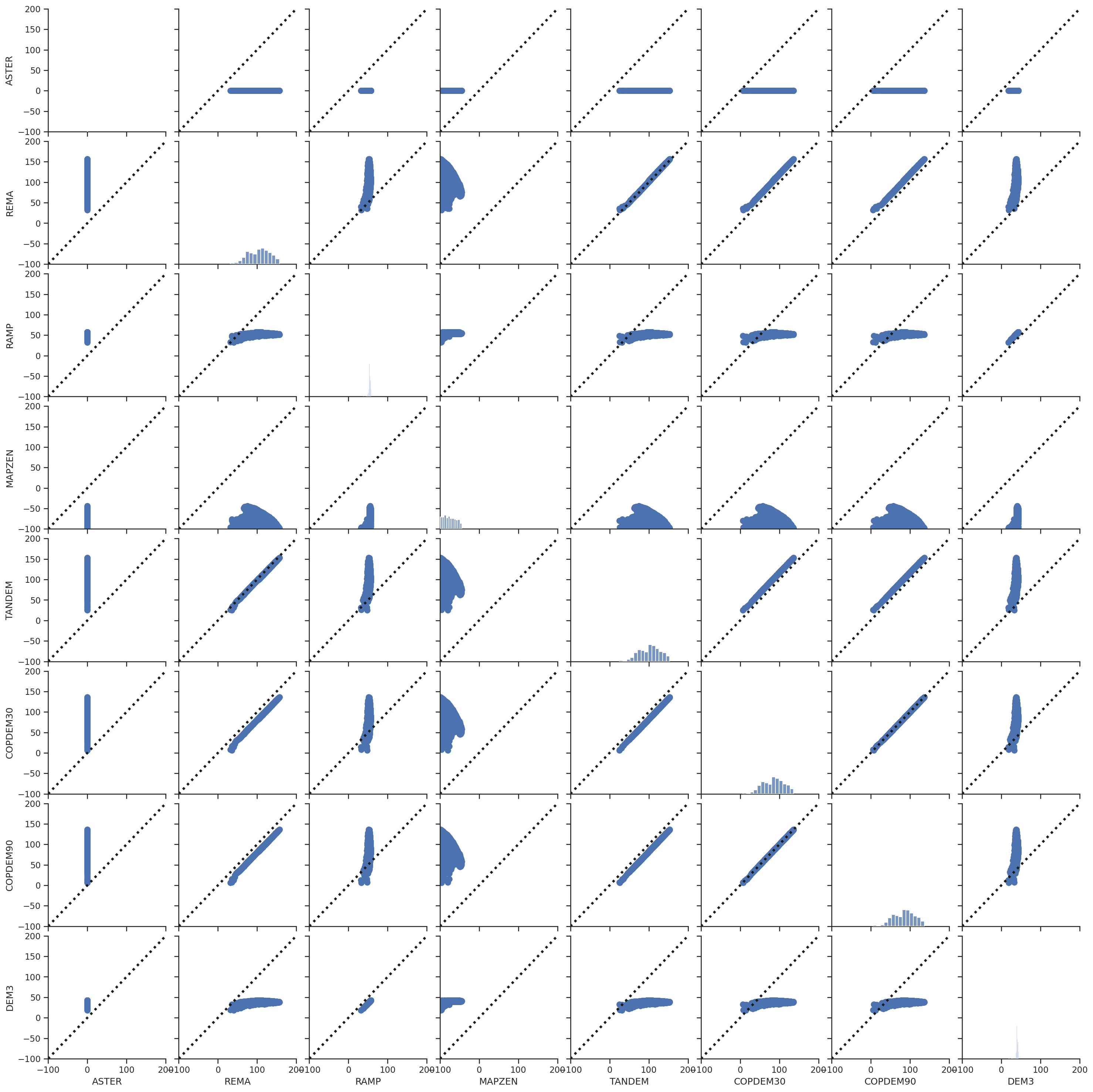
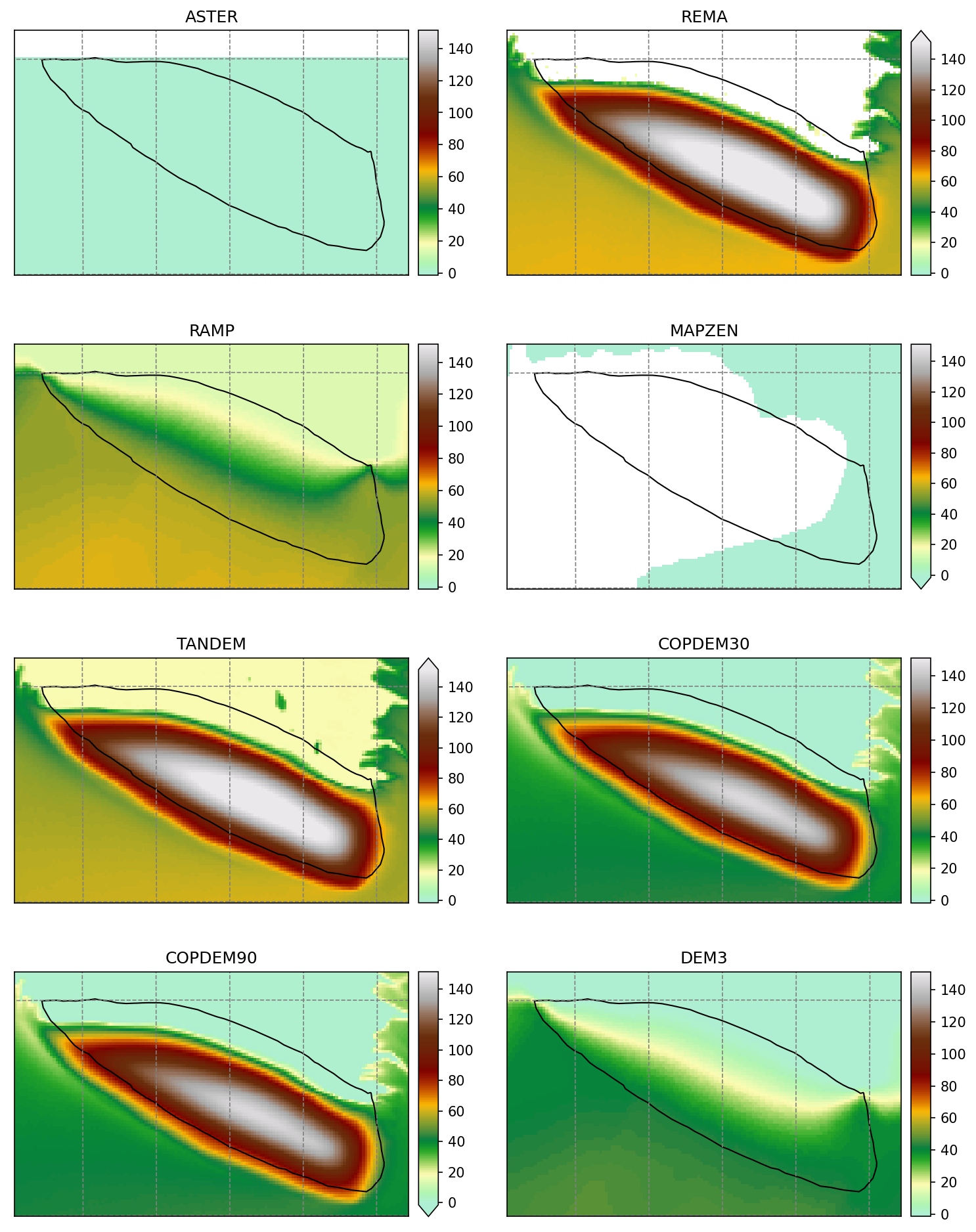
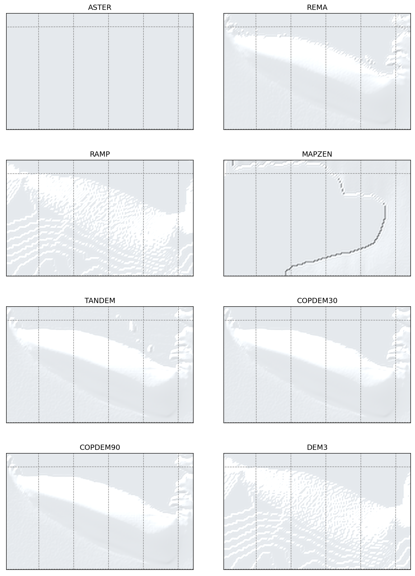
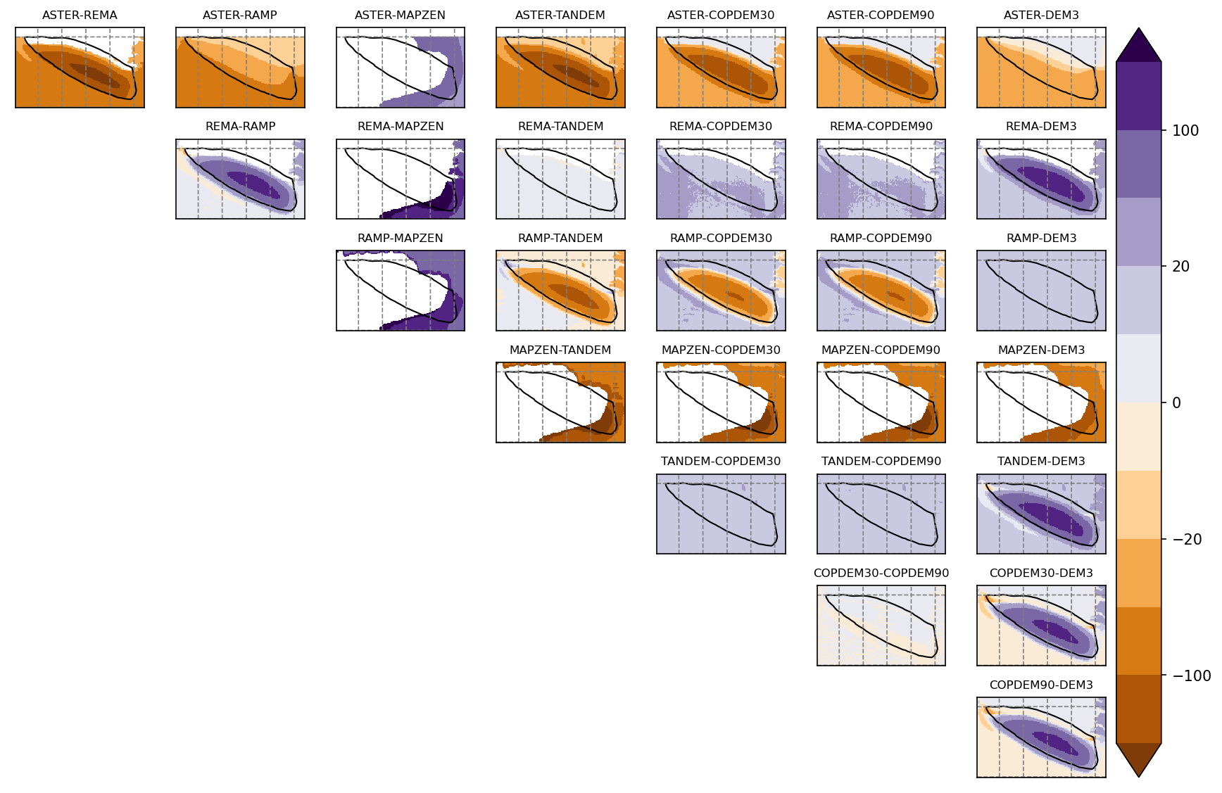
The sources available are: ASTER, REMA, RAMP, MAPZEN, TANDEM-X, COPDEM30, COPDEM90 and DEM3.
Summary
ASTER shows ocean
MAPZEN has no data
TANDEM, COPDEM30 and COPDEM90 are shifted towards the south
DEM3 and RAMP are similiar but show no glacier
Maps
Shaded relief
Differences
Scatter plots
These scatter plots are for the glacier area only.