Gillock Island (Antarctica)
Located at the East Antarctica (70°26’06.0”S 71°48’25.3”E), RGI60-19.01251.
The sources available are: ASTER, AW3D30, COPDEM30, COPDEM90, DEM3, RAMP, REMA, MAPZEN and TanDEM-X.
Summary
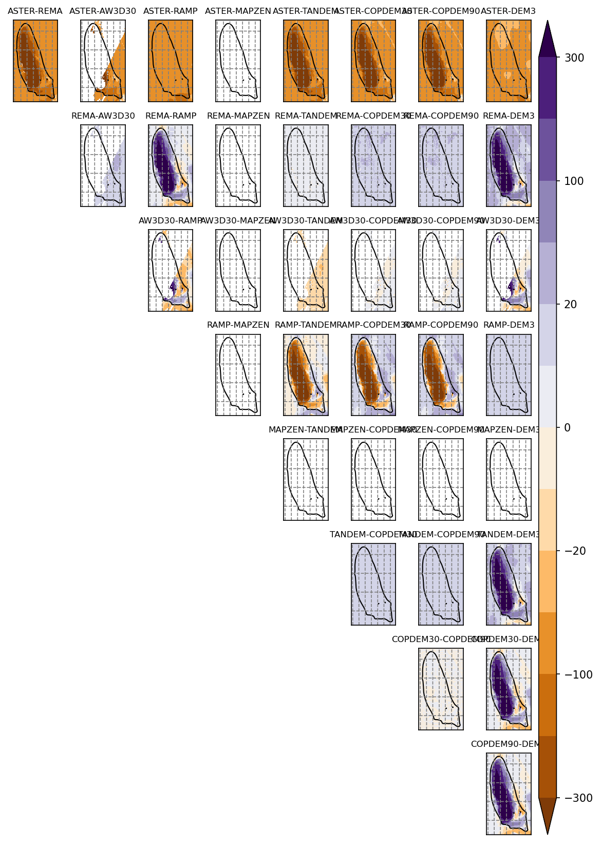
ASTER shows ocean
DEM3 is obviously taken from RAMP
REMA and TanDEM-X agree quite well
REMA has small missing featuers
One of the rare cases where there is no MAPZEN data
AW3D30 has poor data coverage
Maps
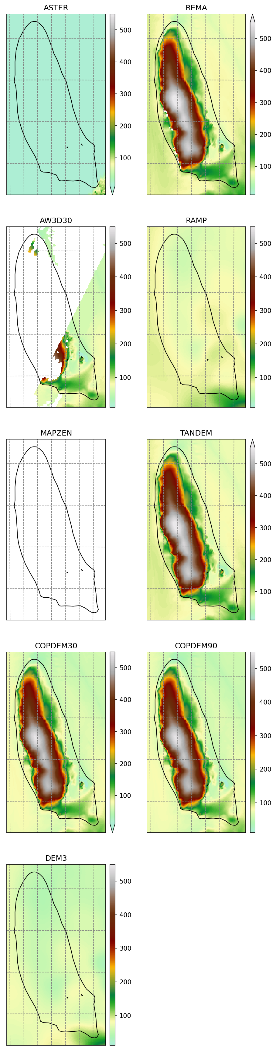
Shaded relief

Differences
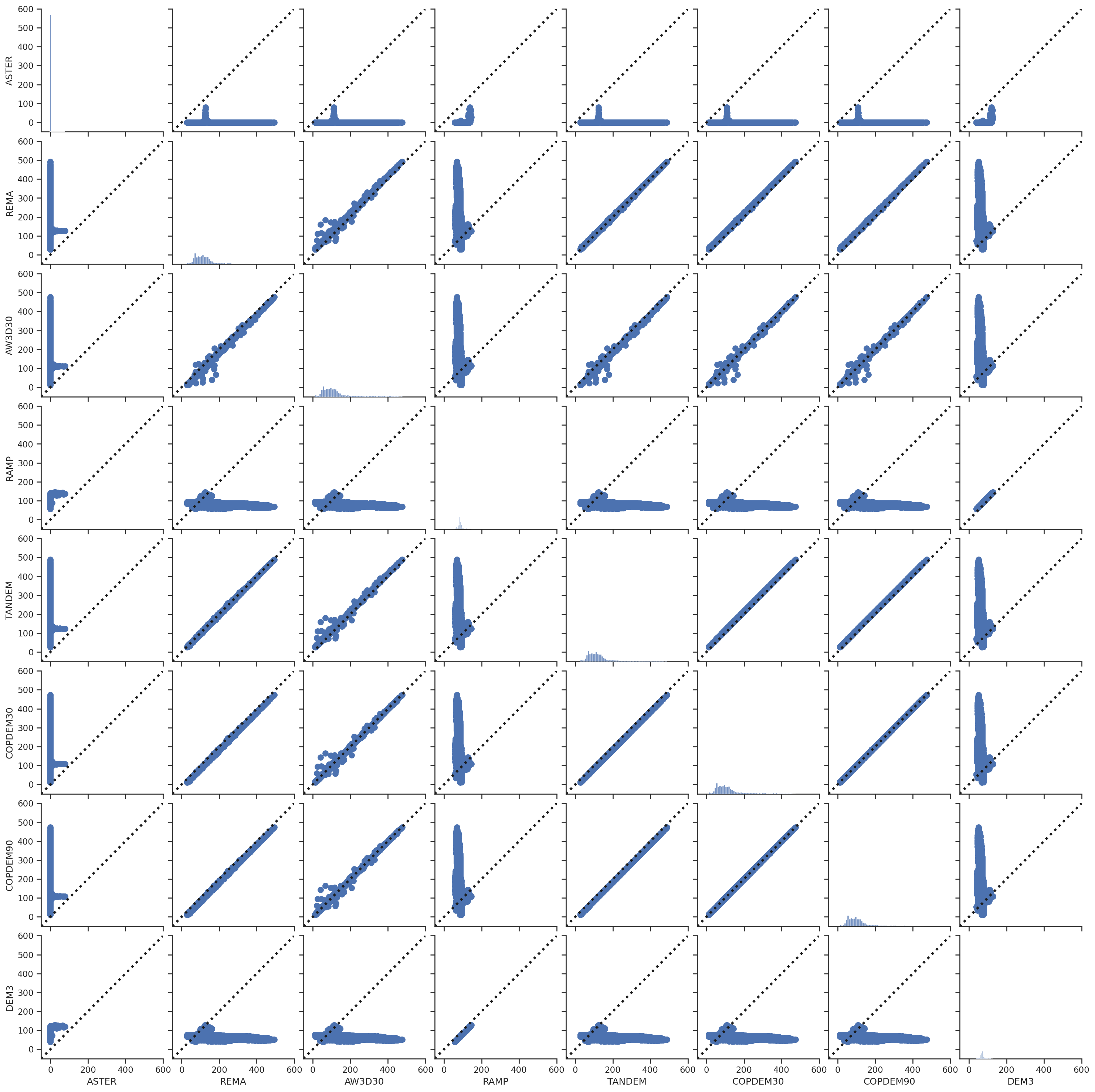
Scatter plots
These scatter plots are for the glacier area only. The plots do not work in that case, as MAPZEN DEM only contains NaN values.