Columbia (Alaska)
Located in Alaska (61°12’02”N 146°54’17”W), RGI60-01.10689.
The sources available are: ASTER, Alaska DEM, COPDEM30, COPDEM90, AW3D30, DEM3, ArcticDEM, TanDEM-X and MAPZEN.
Summary
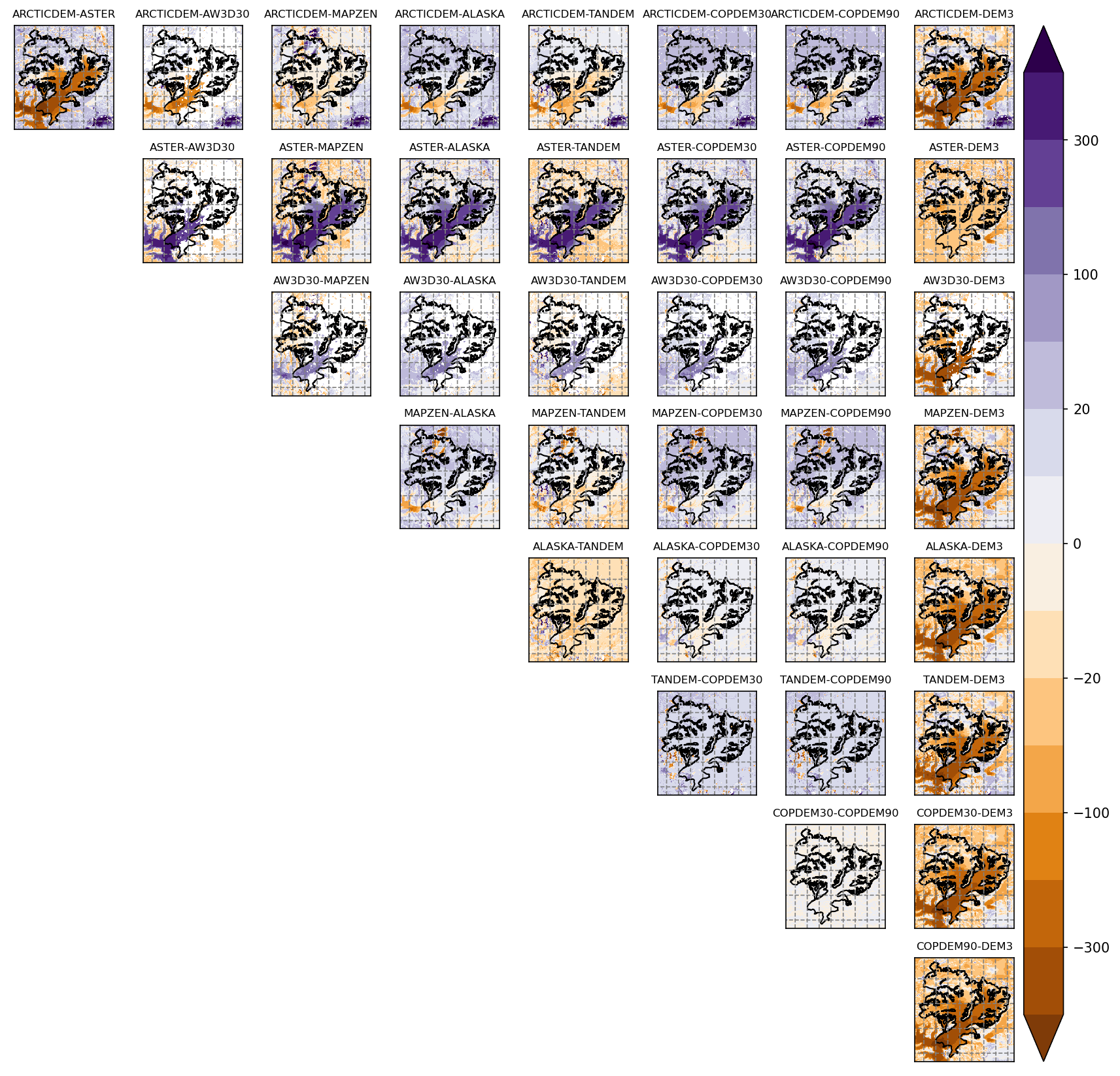
ASTER (when it has no gaps, which is the case here) is noisy over flat glacier surfaces (north-east of the glacier)
DEM3 is obviously based on ASTER but is smoother
clear differences between ASTER and the newer products (TanDEM-X, ArcticDEM) might be due to mass-loss, although it seems exaggerated
it is one of the cases where ArctiDEM has too many data gaps
AW3D30 also hast way to many gaps
Both Alaska and Copernicus DEM are without visual problems and compareable besides some differences in the tongue area.
Maps
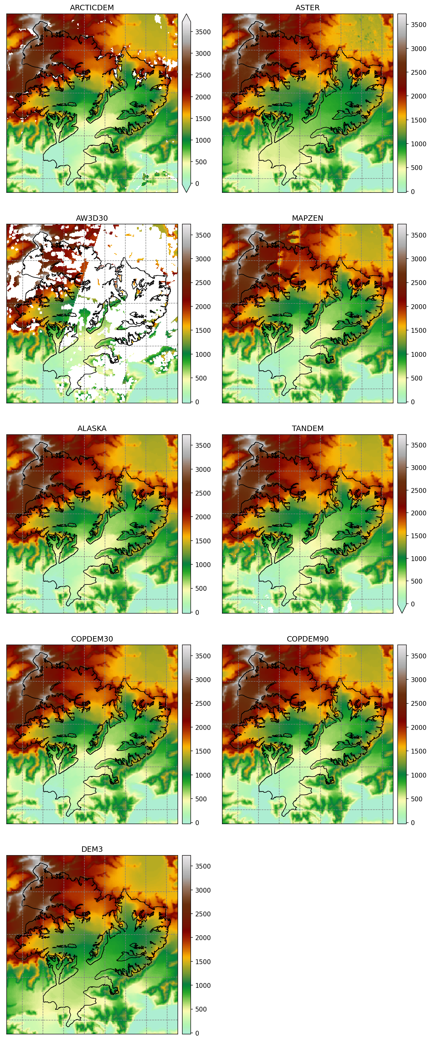
Shaded relief

Differences
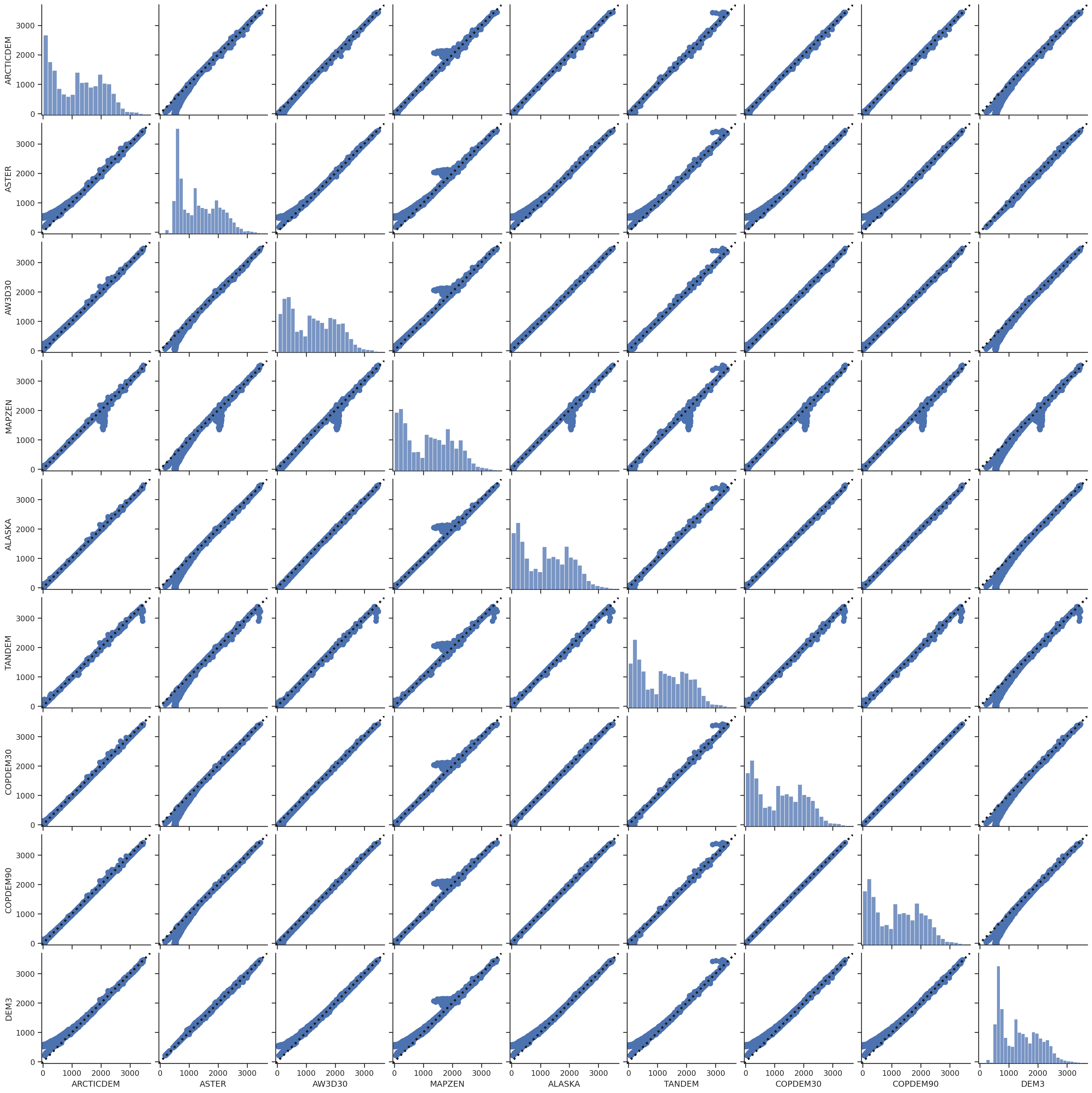
Scatter plots
These scatter plots are for the glacier area only.