Hintereisferner (Alps)
Located in the Austrian Alps (46°47’43”N 10°46’01”E), RGI60-11.00897.
The sources available are: ASTER, COPDEM30, COPDEM90, AW3D30, DEM3, MAPZEN, NASADEM, SRTM and TanDEM-X.
Summary
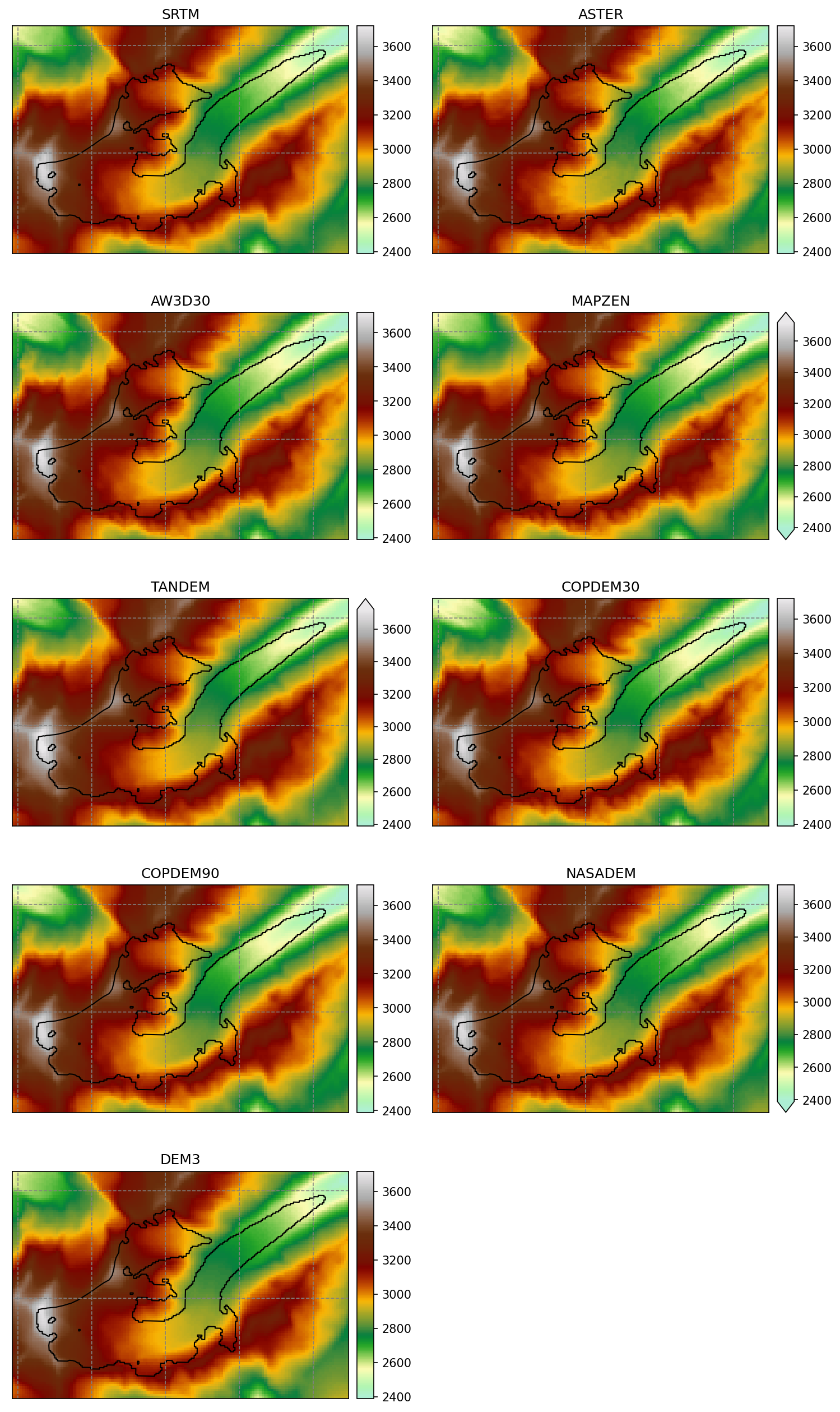
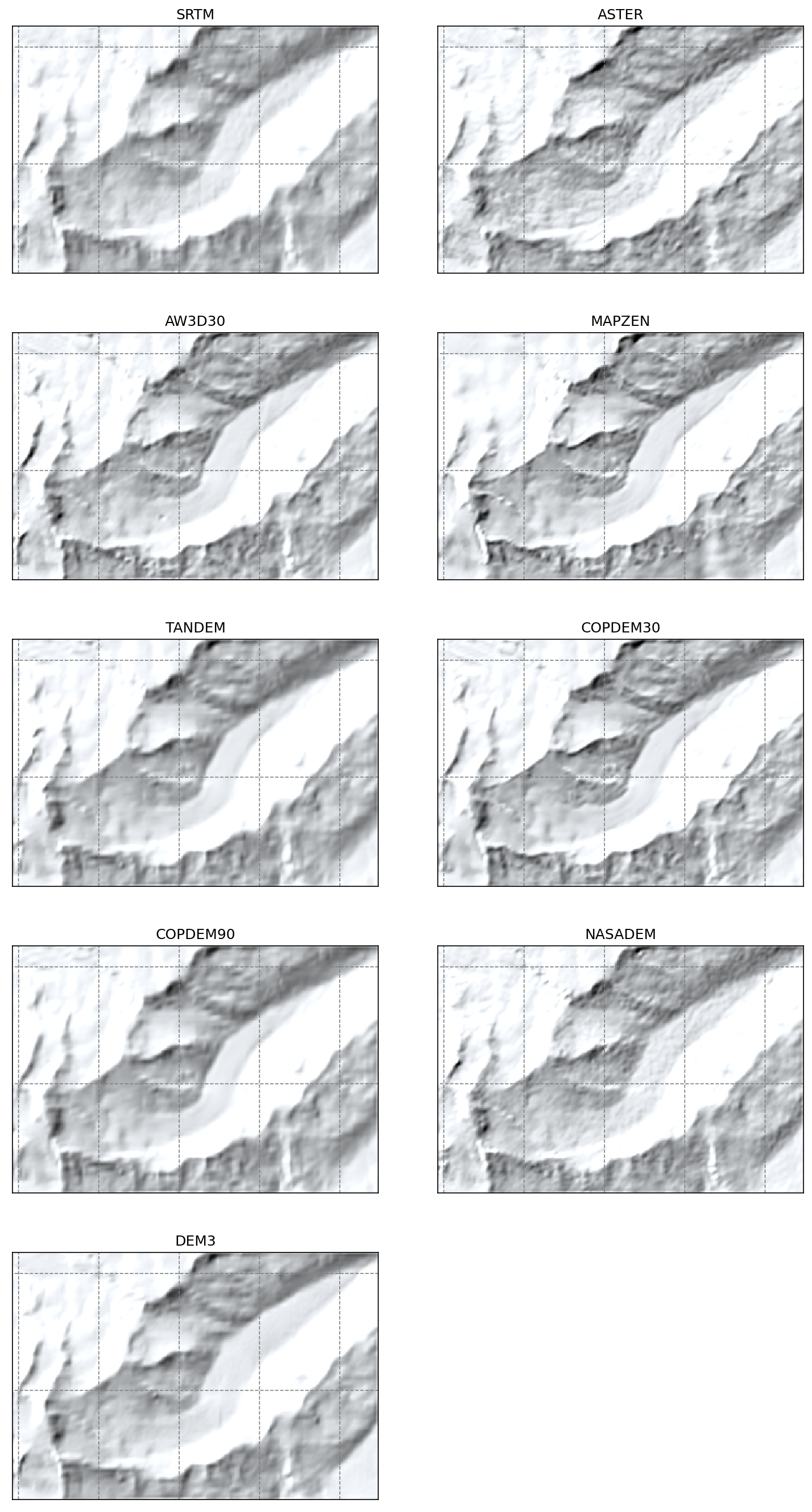
in an easy location in the mid-latitudes, all DEMs are qualitatively OK
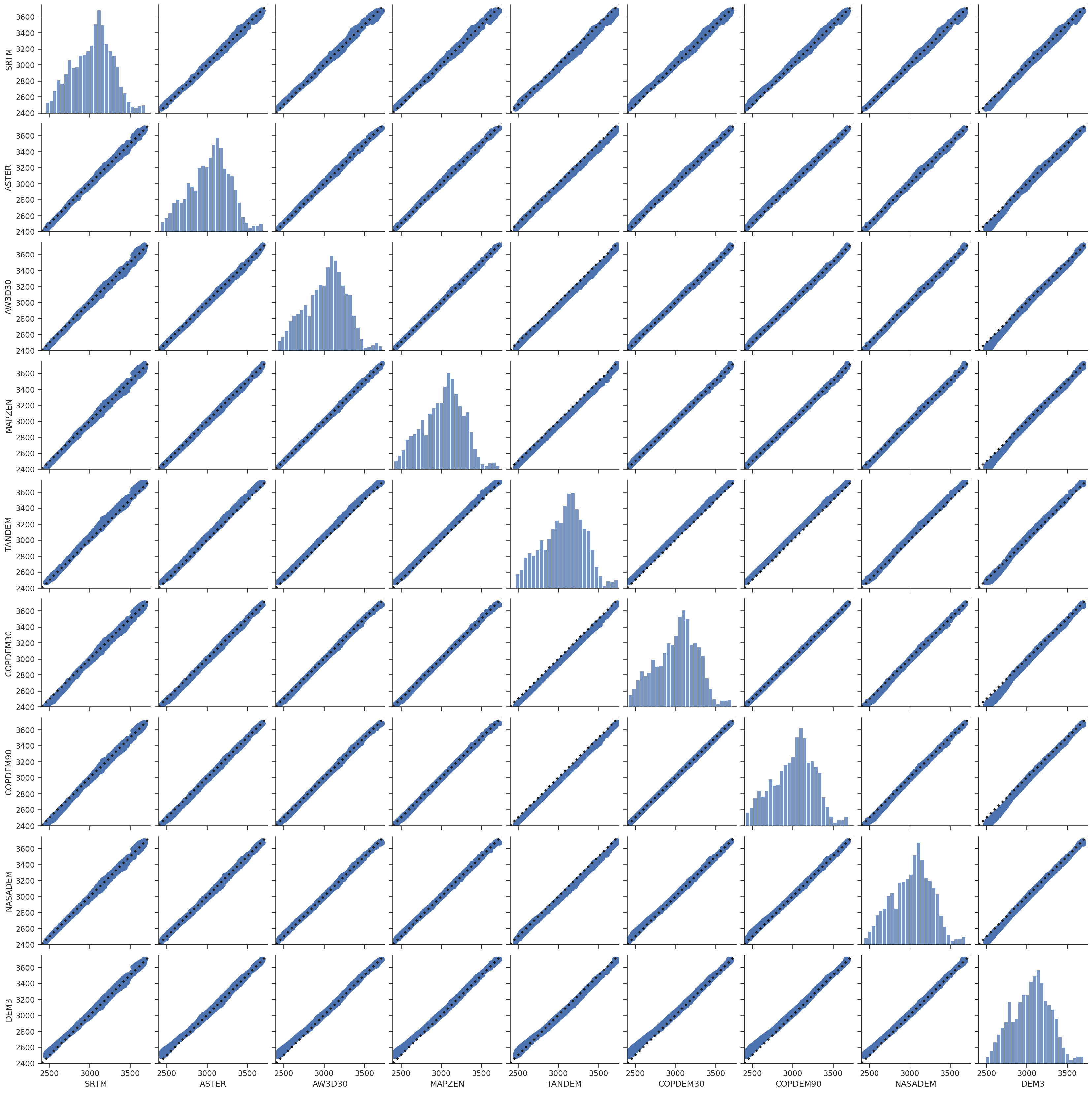
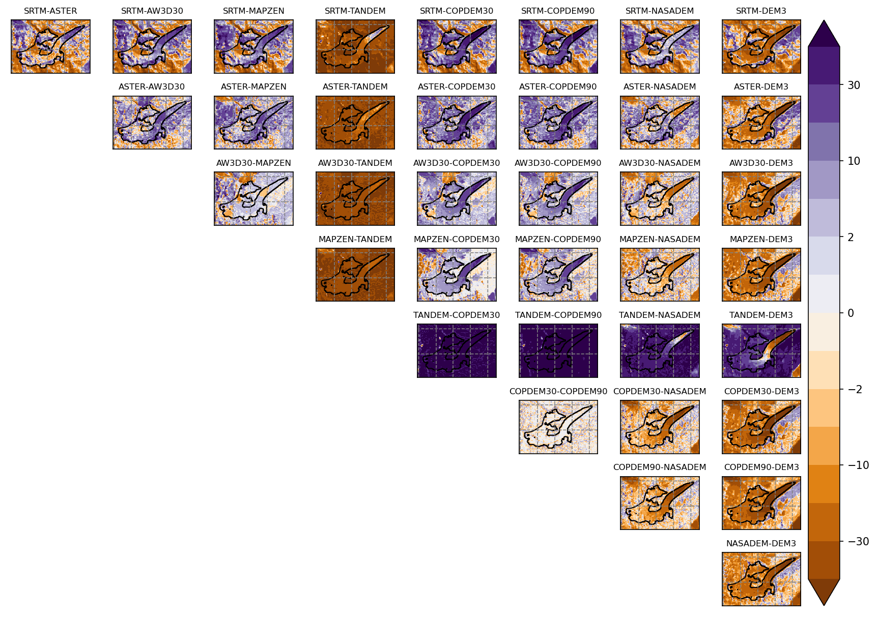
DEM3 is the most different from all, with an obvious higher elevation tongue
worrying generalised bias between SRTM and TanDEM-X, the latter being higher of 40m in average
ASTER and SRTM agree the most
NASADEM shows noticeable differences to SRTM in steeper (often unglaciated areas) which are also present in e.g. AW3D30. But the flatter parts of the glacier are very similar.
Maps
Shaded relief
Differences
Scatter plots
These scatter plots are for the glacier area only.