Balleny Islands (Antarctica)
Located at the Antarctic Peninsula (67°26’33.0”S 164°45’21.6”E), RGI60-19.00783.
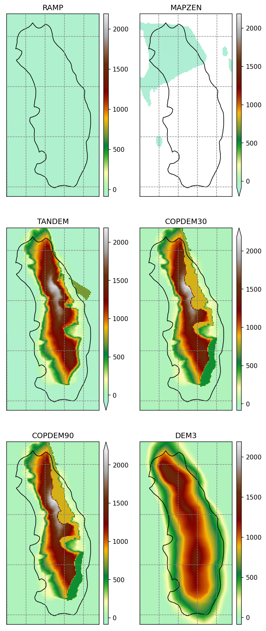
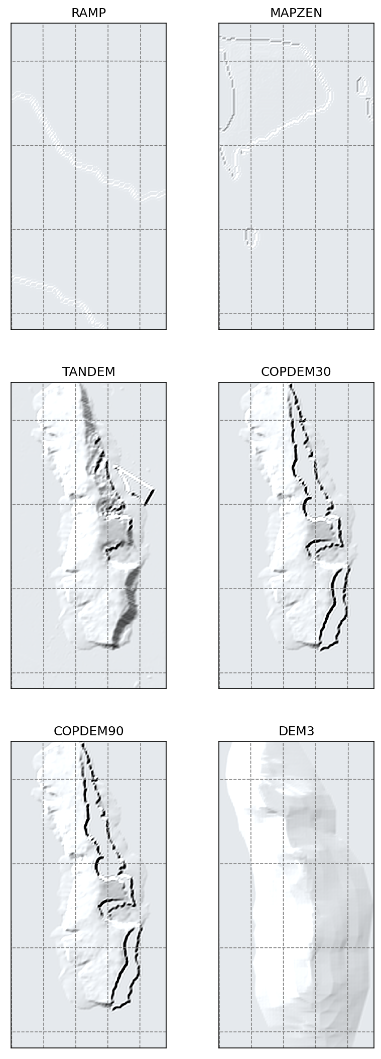
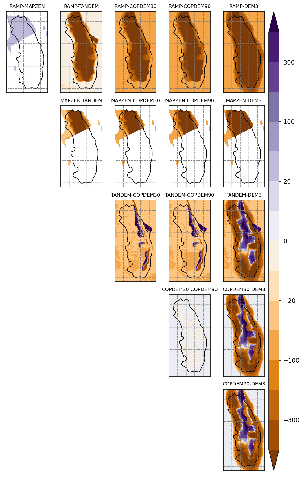
The sources available are: RAMP, MAPZEN, TANDEM-X, COPDEM30, COPDEM90 and DEM3.
Summary
RAMP shows ocean
MAPZEN shows no data or ocean
TANDEM, COPDEM30 and COPDEM90 don’t match the outline and have artifacts
DEM3 matches the outlines the best
Maps
Shaded relief
Differences
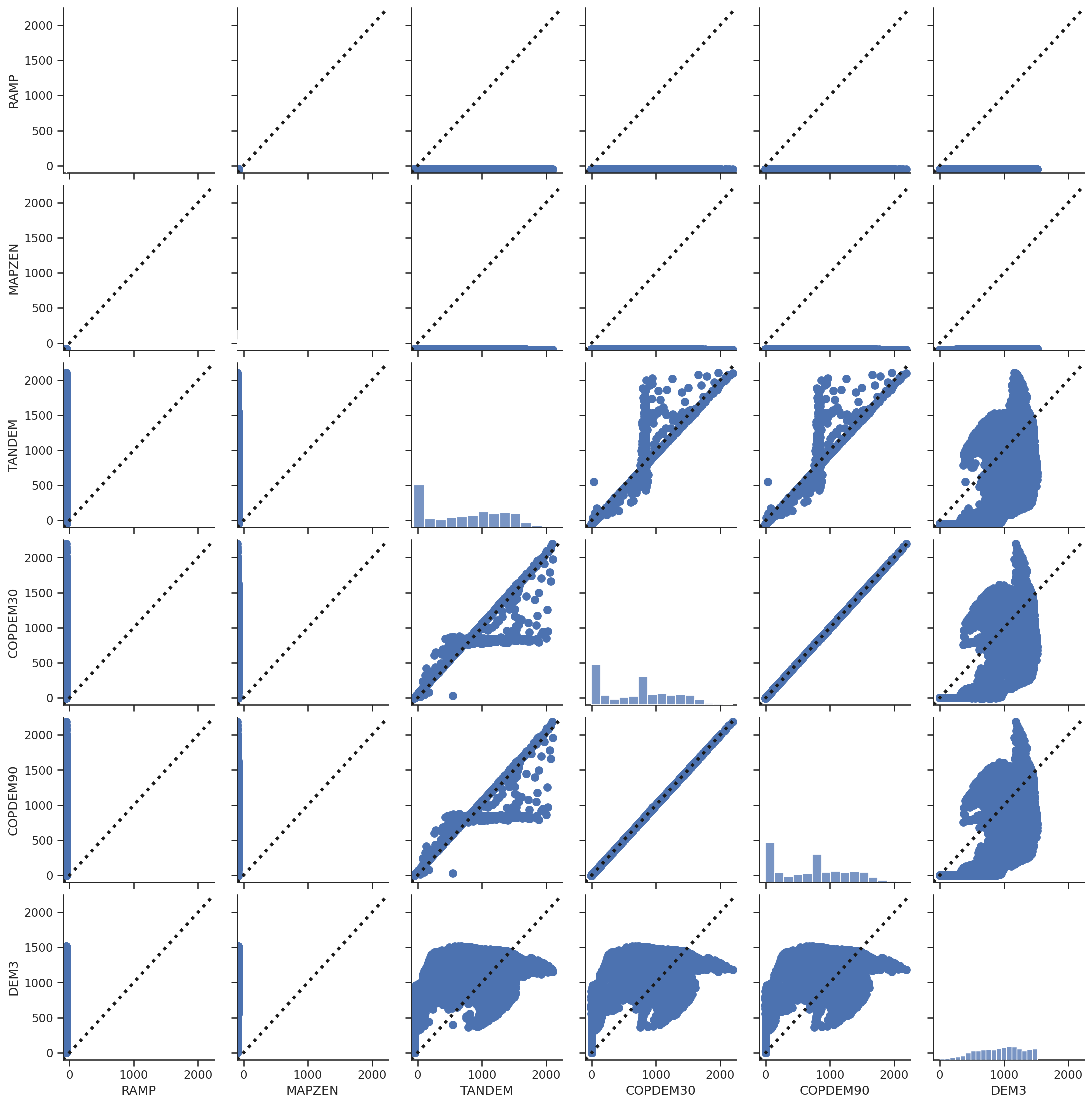
Scatter plots
These scatter plots are for the glacier area only.