Known issues in RGI V6
This page has moved! To read current issues (and add your own), visit: https://github.com/GLIMS-RGI/rgi_issue_tracker
Data files (RGI6)
The file
01_rgi60_Alaska_hypso.csvcontains RGI IDs which are still labelled as RGI50.The column
Zmedin the file ‘19_rgi60_AntarcticSubantarctic.shp’ contains only missing datain the summary file, the RGI subregions of Region 08 (Scandinavia) are wrongly named and the subregion 08-03 as defined in the technical report is missing.
the files 00_rgi60_O1Regions.shp and 00_rgi60_O2Regions.shp contain polygons describing the boundaries of all RGI regions and subregions. 149 RGI glaciers do not pass the geometrical test: reg_region.contains(rgi_center_point).
Undivided glacier complexes
Large, undivided glacier complexes are the major obstacle towards distributed flowline modelling at the global scale. Here we will list the major glacier complexes that need to be divided.
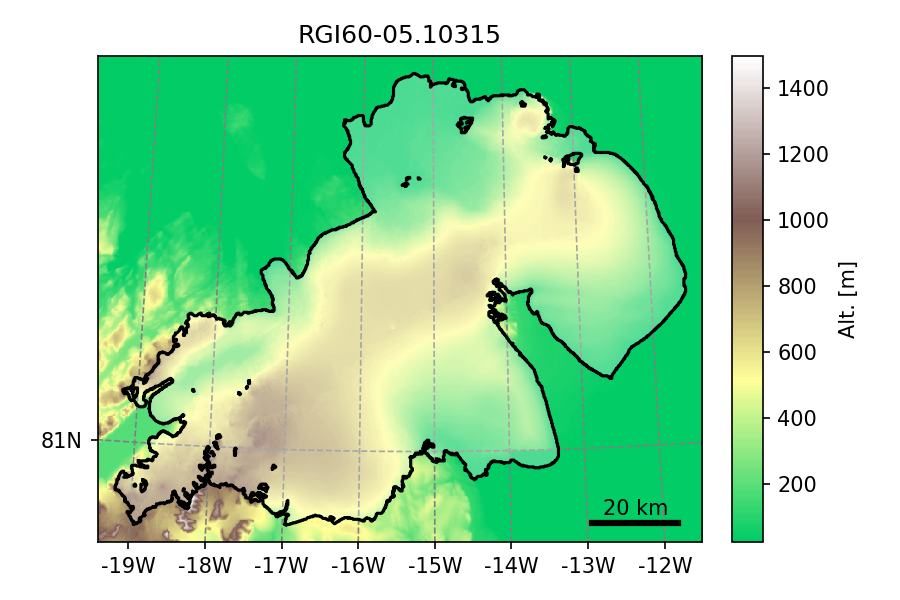
A prominent example is glacier 'RGI60-05.10315' an ice-cap in
north-east Greenland and also the largest RGI entity (by far) with
7537 km \(^2\):
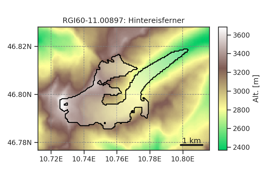
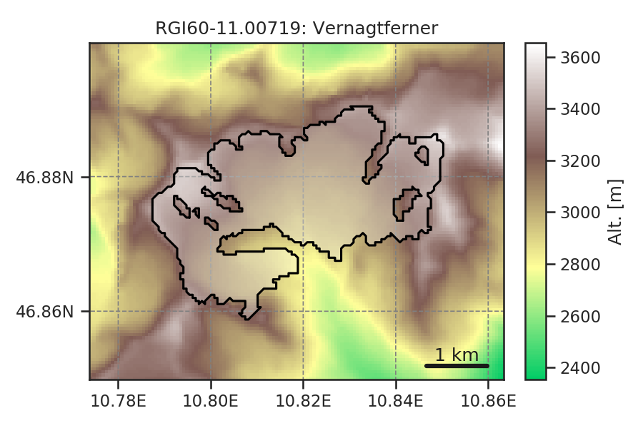
Other examples include glacier complexes which have been merged into one glacier entity for historical reasons. For example, Hintereisferner and Vernagtferner in the Austrian Alps should actually be divided into several entities:
Noisy DEM data
RGI does not currently ship DEM data directly, but only as aggregated, hypsometry statistics. We know however that these statistics might rely on a noisy DEM map (see this blog post for more information). This is very unlikely to have any significant influence on the aggregated statistics, since the DEMs are mostly correct and just noisy.