Alexander Island (Antarctica)
Located at the Antarctic Peninsula (72°30’59.8”S 71°18’00.1”W), RGI60-19.00124.
The sources available are: ASTER, AW3D30, COPDEM30, COPDEM90, DEM3, RAMP, MAPZEN and TanDEM-X.
Summary
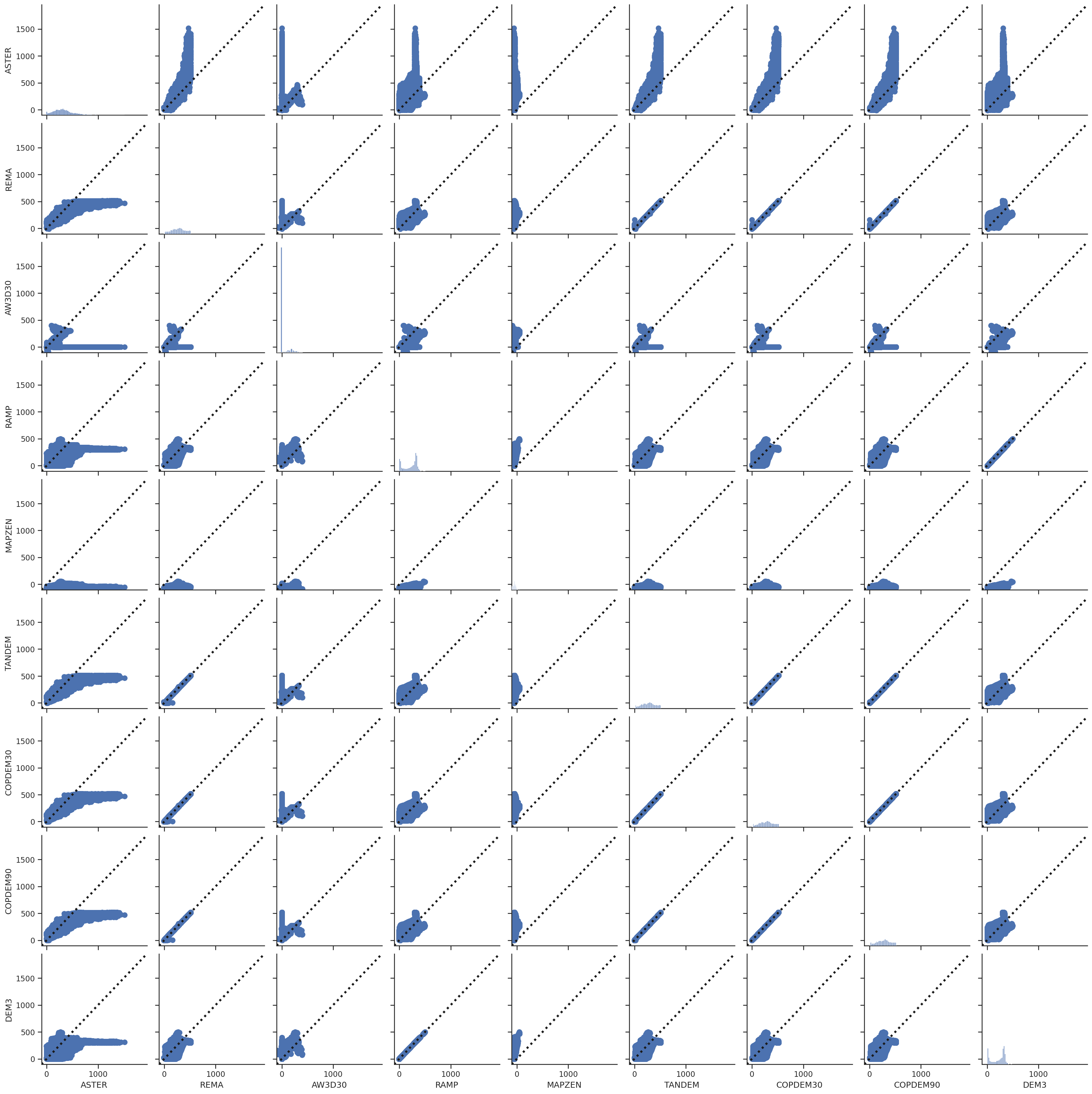
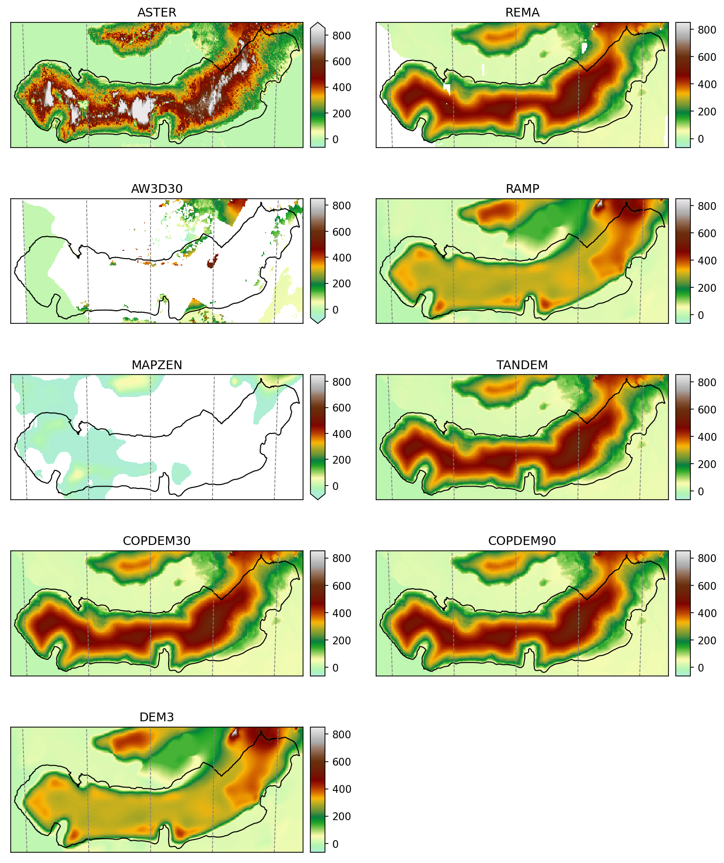
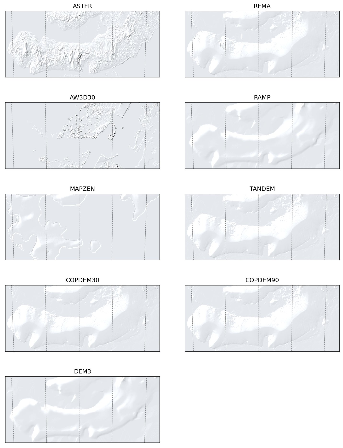
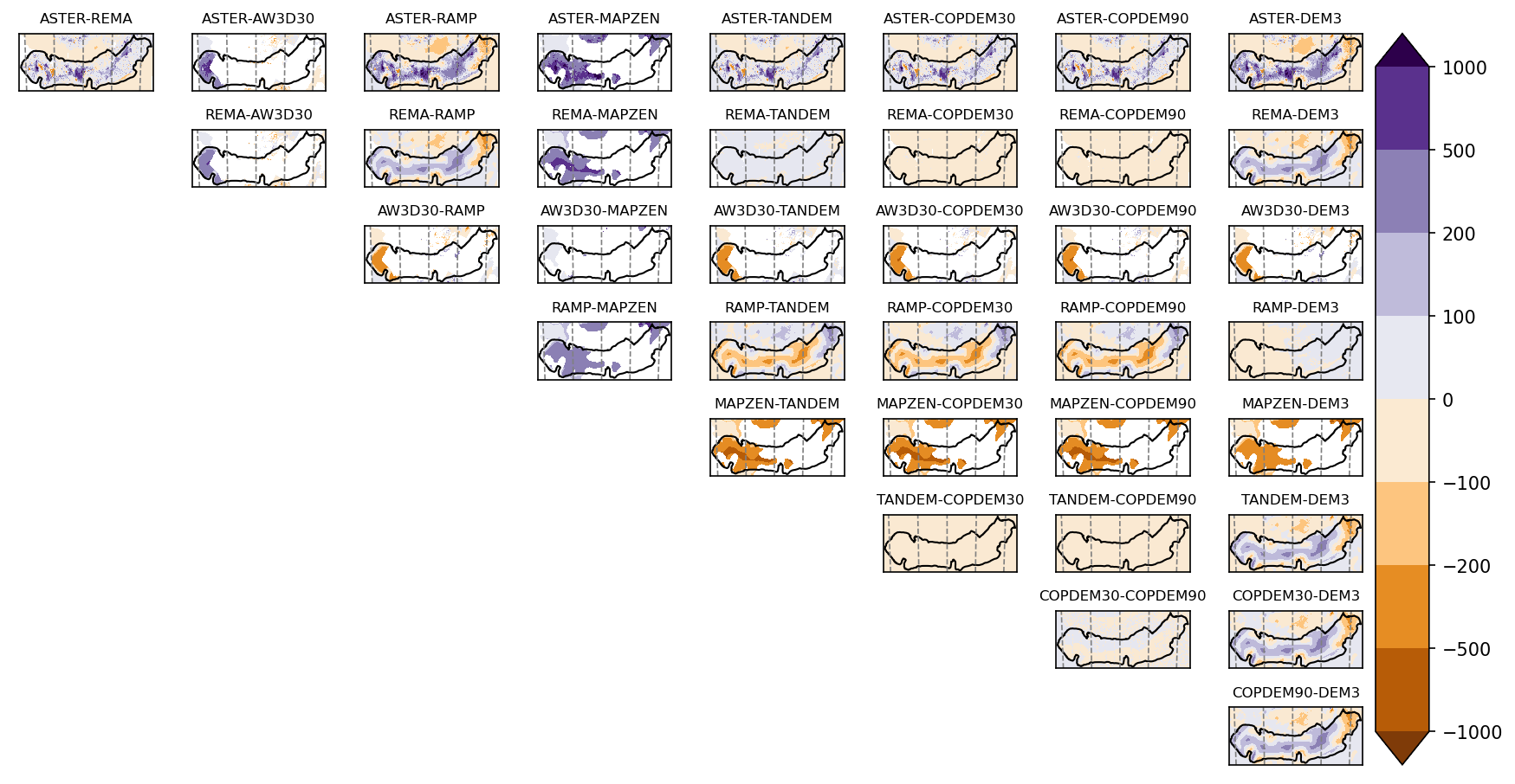
ASTER has a lot of noise
DEM3 is obviously taken from RAMP
One of the rare cases where there is no proper MAPZEN data
AW3D30 has poor data coverage
Maps
Shaded relief
Differences
Scatter plots
These scatter plots are for the glacier area only.