Dyngjujoekull (Iceland)
Located in Iceland (64°43’03”N 17°03’28”W), RGI60-06.00477.
The sources available are: ASTER, COPDEM30, COPDEM90, AW3D30, ArcticDEM, DEM3, MAPZEN and TanDEM-X.
Summary
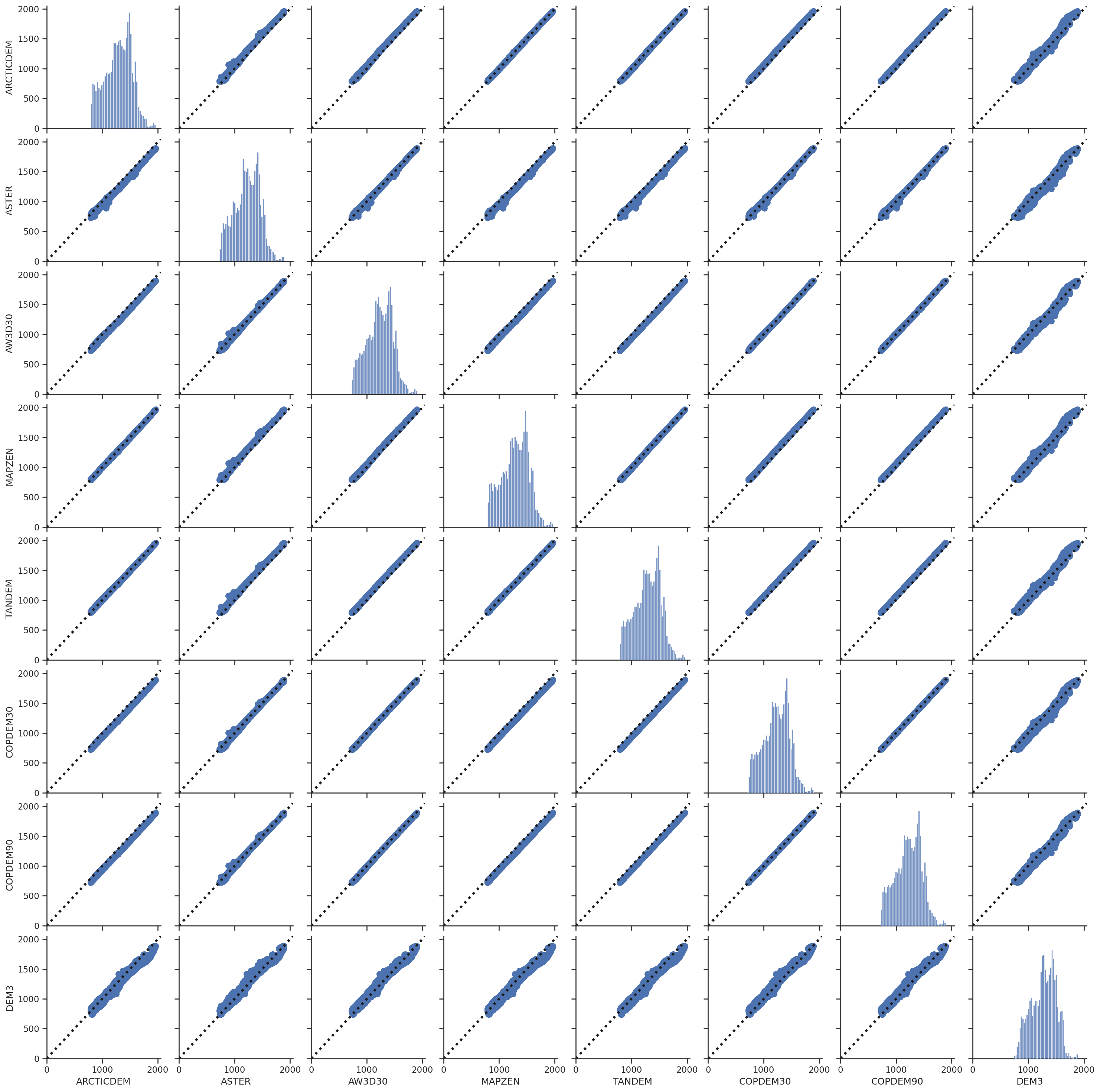
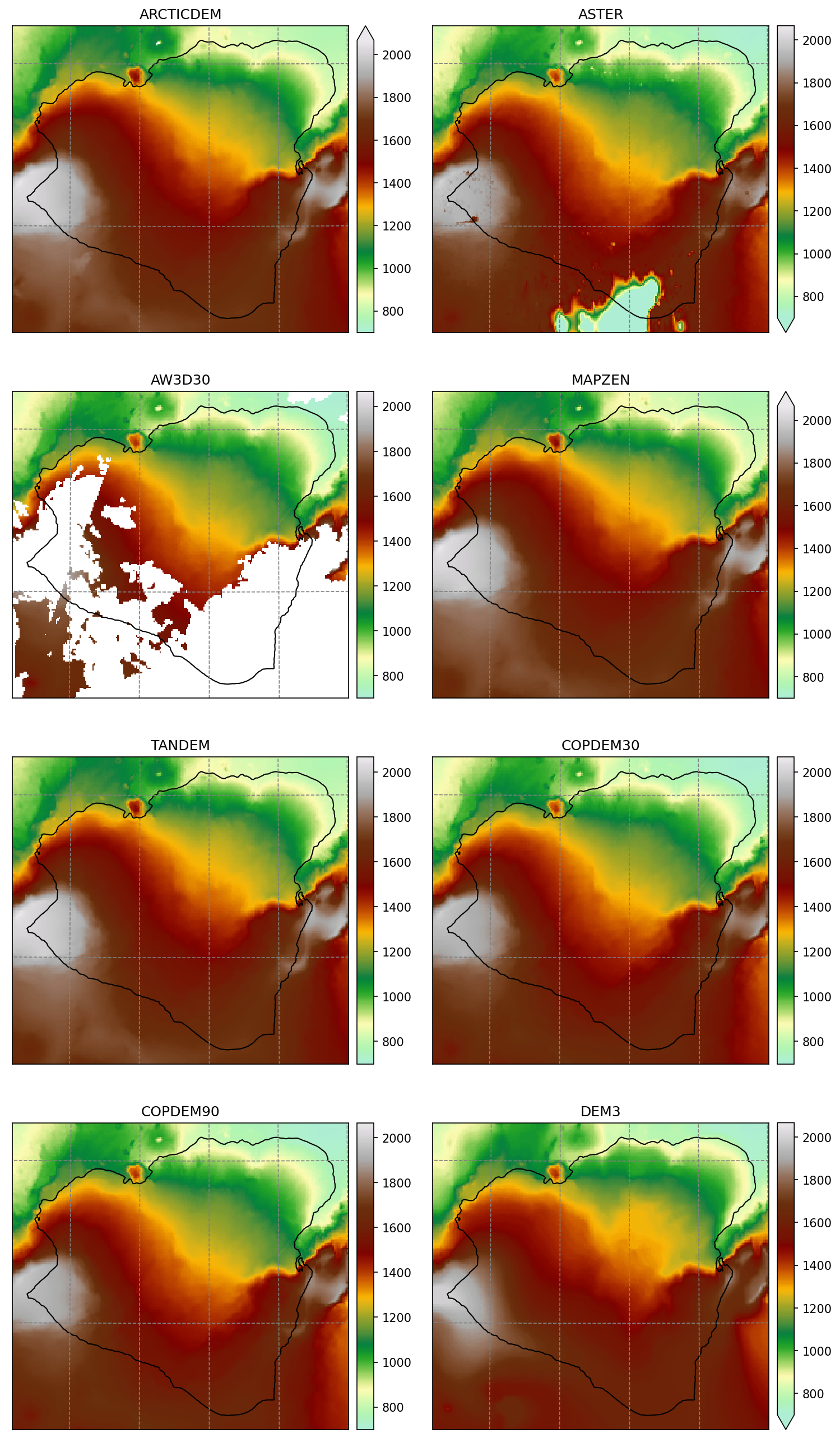
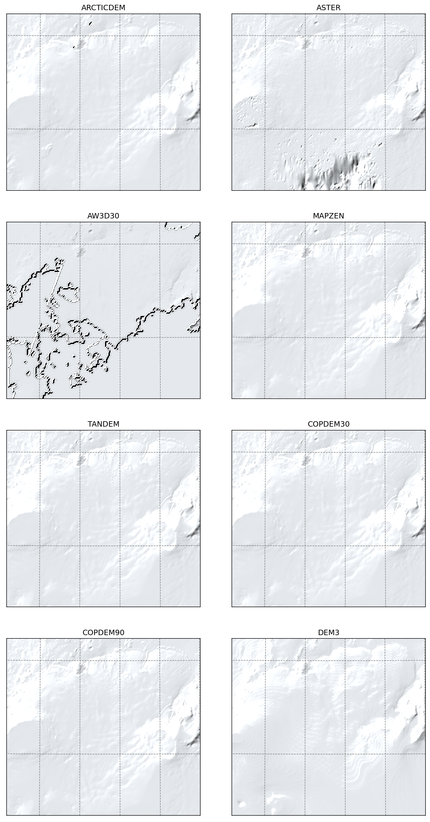
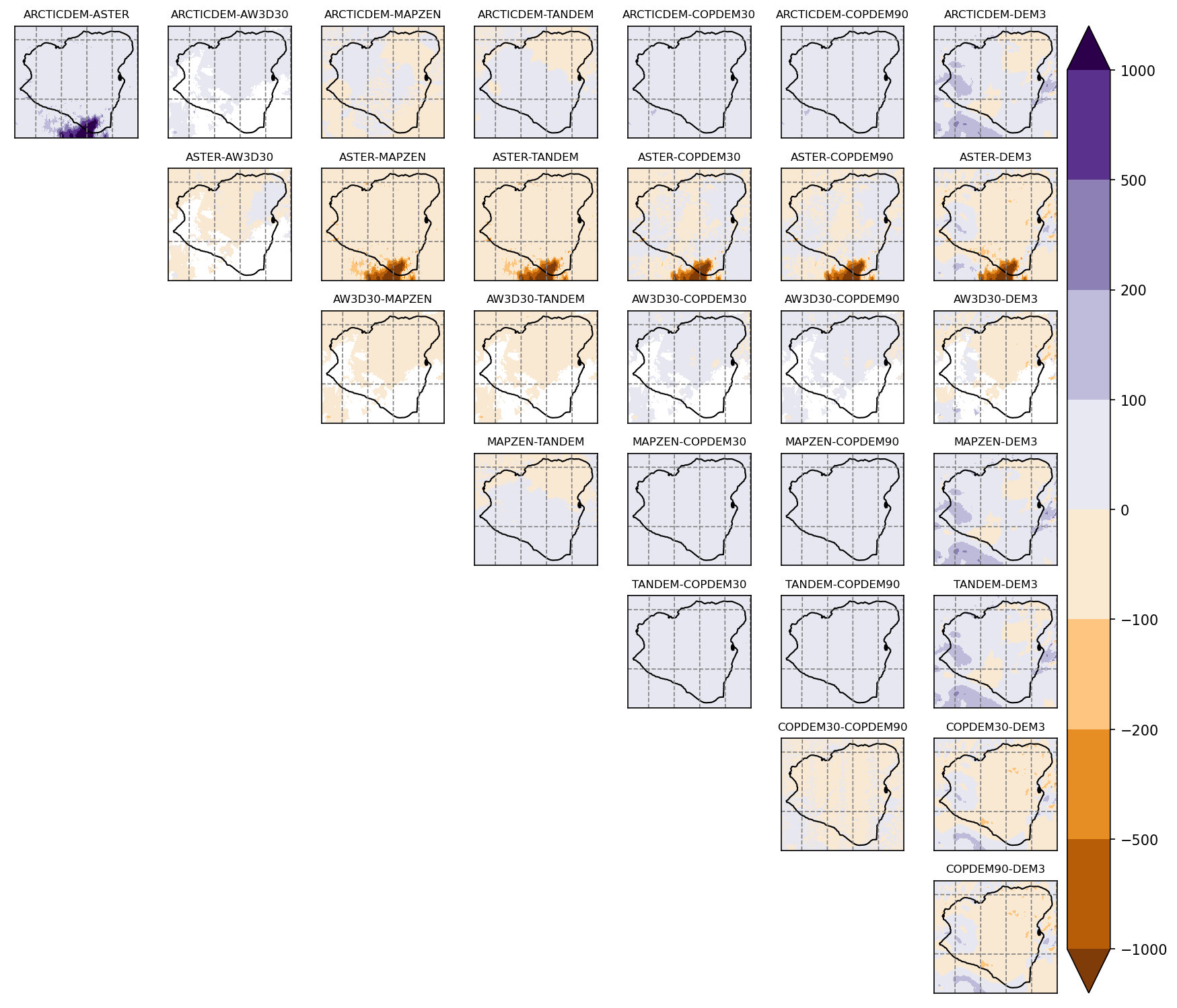
ASTER is very bad. The artefacts are not flagged as missing data like it mostly is in TanDEM-X or ArcticDEM
TanDEM-X and ArcticDEM agree well
DEM3 was generated before these new products, so I guess that a little bit of magic was needed to generate the map
AW3D30 misses huge junks
Maps
Shaded relief
Differences
Scatter plots
These scatter plots are for the glacier area only.