Pine Island Bay (Antarctica)
Located at the Antarctic Peninsula (73°08’40.6”S 105°05’34.8”W), RGI60-19.01405.
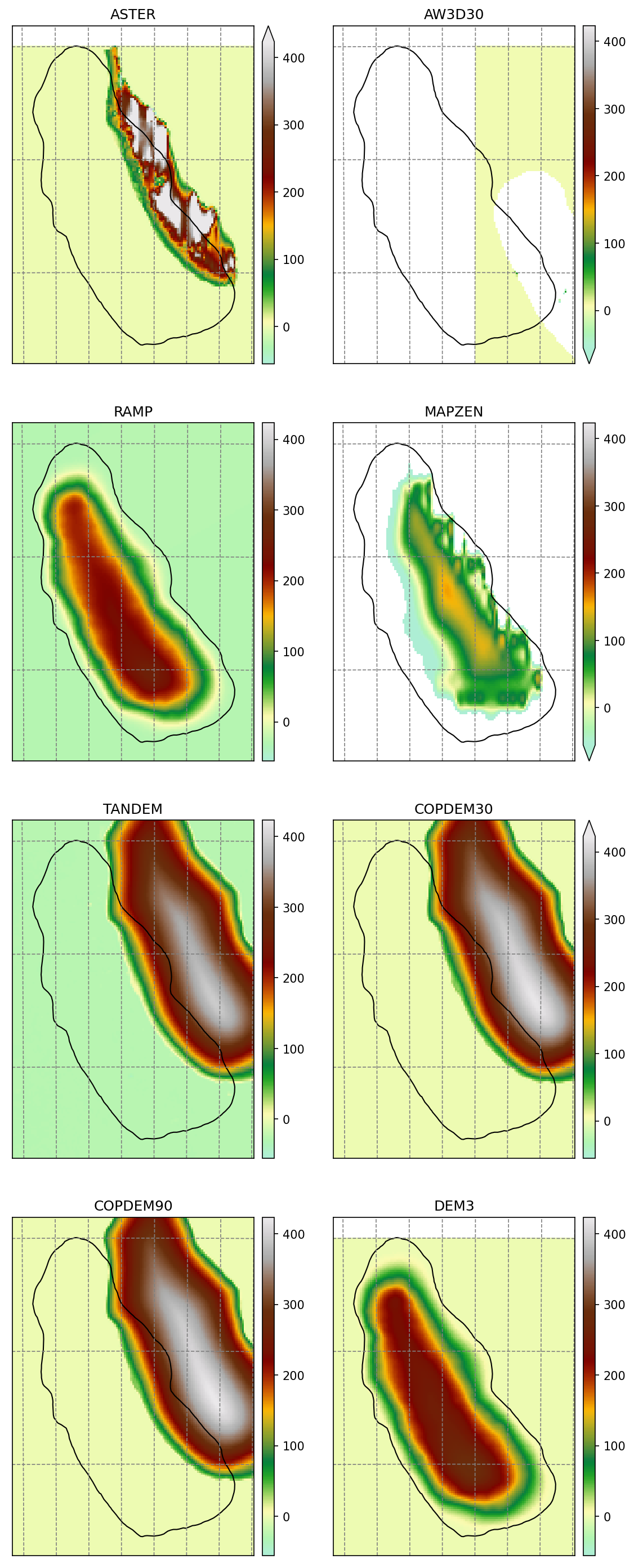
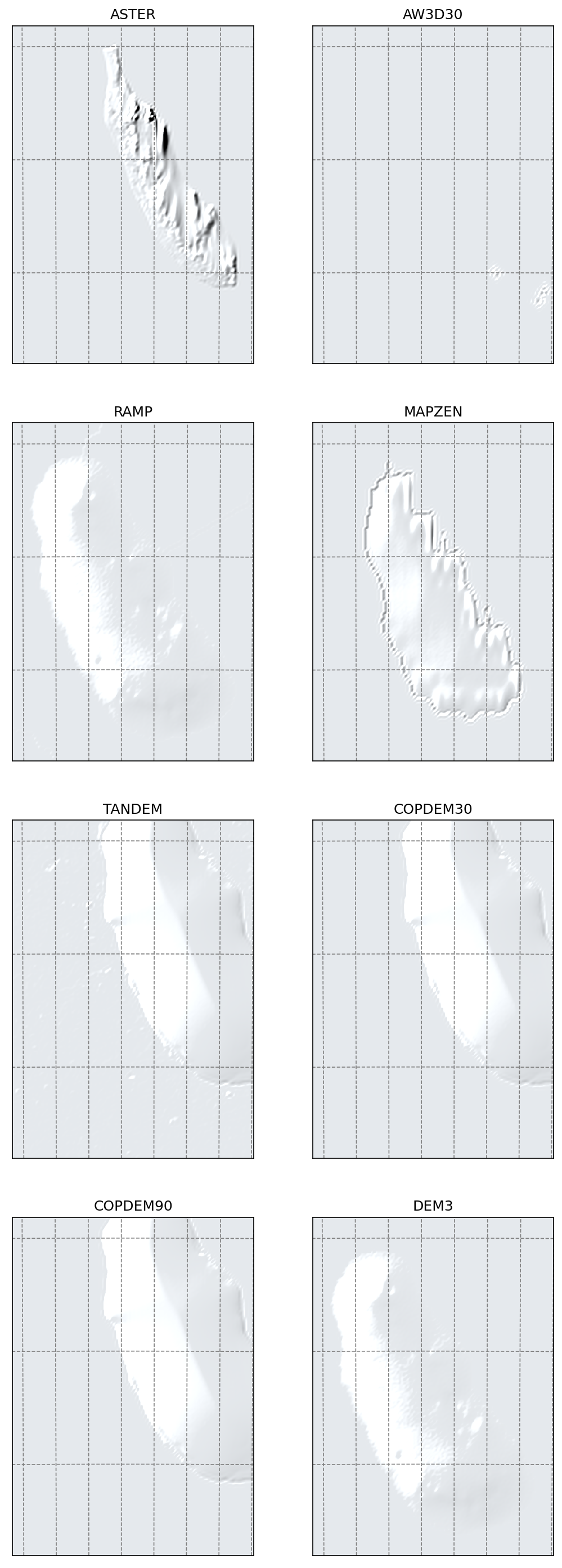
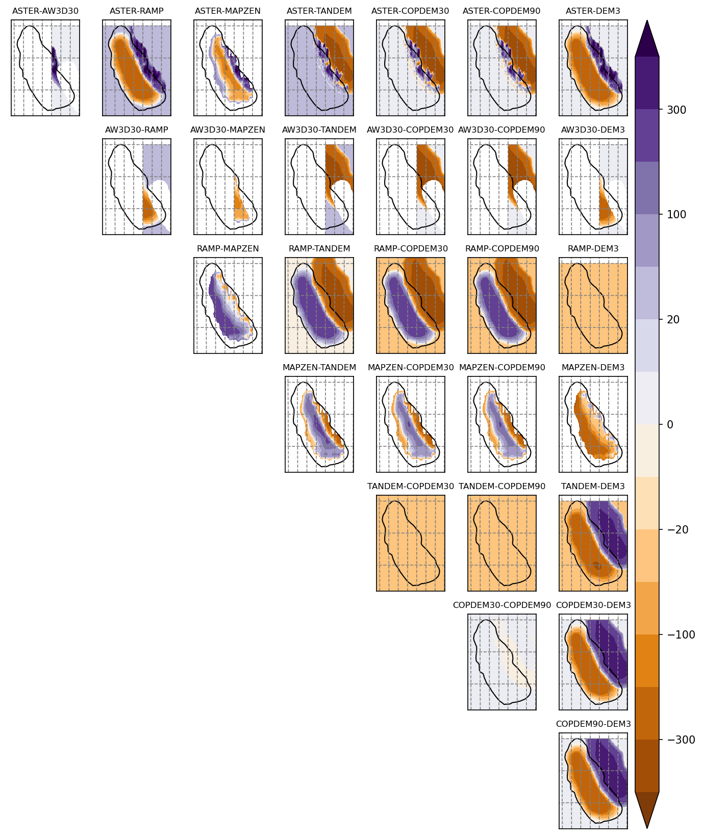
The sources available are: RAMP, MAPZEN, TANDEM-X, COPDEM30, COPDEM90 and DEM3.
Summary
TANDEM, COPDEM30 and COPDEM90 DEMs are clearly shifted to the north-east
AW3D30 has no data
MAPZEN and ASTER are noisy and a bit shifted to the east
DEM3 is taken from RAMP
Maps
Shaded relief
Differences
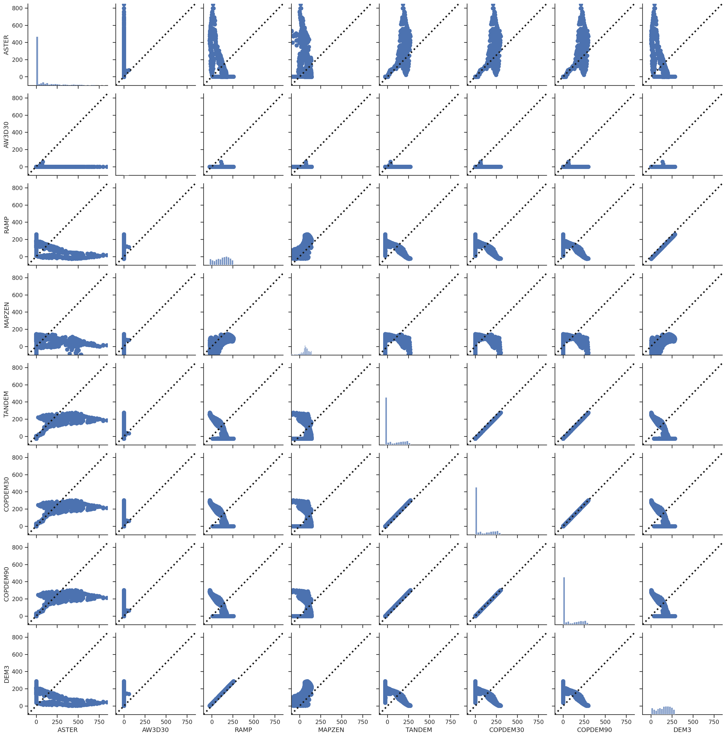
Scatter plots
These scatter plots are for the glacier area only.